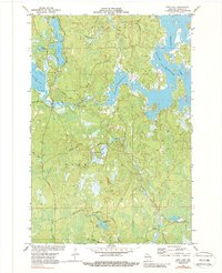
1971 Map of Pier Lake
USGS Topo · Published 1988About this map
St Francis of Assisi Ch stands near the western shore of Pier Lake, serving as a primary landmark in a landscape dominated by the complex hydrology of the Willow Reservoir. This 1971 survey captures the Northwoods character of Oneida County, where the sprawling fingers of the reservoir meet established water bodies like Willow Lake and Lake Junnie. The map illustrates a region defined by its water management and forestry infrastructure, shown through a network of fire lanes and primitive roads like the Kelly Fire Lane and Mc Cord Road.
Find a feature on this map
28 named features on this map. Tap any name to fly to it.
Don’t see what you’re looking for? This feature index may not catch every label — zoom into the map to look around manually.
Map Details
Editions of this 1971 Pier Lake Map
2 editions found
Other maps of this area

1938 · Lac Du Flambeau
USGS Topo · 1:48,000

1939 · Lac Du Flambeau
USGS Topo · 1:48,000

1939 · Mc Cord
USGS Topo · 1:48,000

1941 · Pike Lake
USGS Topo · 1:48,000

1941 · Brantwood
USGS Topo · 1:48,000

1942 · Pike Lake
USGS Topo · 1:48,000

1943 · Brantwood
USGS Topo · 1:48,000

1946 · Lac Du Flambeau
USGS Topo · 1:48,000

1947 · Mc Cord
USGS Topo · 1:48,000

1950 · Pike Lake
USGS Topo · 1:48,000