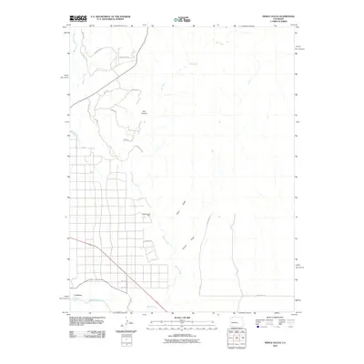
2010 Map of Pierce Gulch
USGS Topo · Published 2010About this map
Arkansas River frontage and the industrial settlement of Concrete anchor the southern portion of this landscape at the dawn of the 21st century. The map reveals a transition from the structured grid of the town and neighboring rural roads like Old Portland Rd into a rugged northern terrain defined by drainage systems and mineral extraction. The presence of the Beaver Creek Mine near the center of the sheet reflects the region's enduring connection to mining, while the complex network of trails such as Two Buttes Trl and Topnotch Trl suggests a modern land use dominated by recreation or ranching access. Water management is a visible priority in this arid environment, evidenced by the Brush Hollow Supply Ditch and the primary flows of Beaver Creek and Red Creek which carve through landmarks like Salt Canyon.
Find a feature on this map
26 named features on this map. Tap any name to fly to it.
Don’t see what you’re looking for? This feature index may not catch every label — zoom into the map to look around manually.
Map Details
Editions of this 2010 Pierce Gulch Map
This is the sole edition of this map. No revisions or reprints were ever made.
Other maps of this area

1889 · Canon City
USGS Topo · 1:125,000

1891 · Pueblo
USGS Topo · 1:125,000

1892 · Canon City
USGS Topo · 1:125,000

1893 · Colorado Springs
USGS Topo · 1:125,000

1894 · Pikes Peak
USGS Topo · 1:125,000

1894 · Pueblo
USGS Topo · 1:125,000

1896 · Pueblo
USGS Topo · 1:125,000

1897 · Pueblo
USGS Topo · 1:125,000

1901 · Pikes Peak
USGS Topo · 1:125,000

1909 · Colorado Springs
USGS Topo · 1:125,000