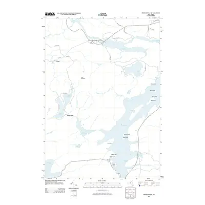
2013 Map of Piercefield
USGS Topo · Published 2013About this map
Piercefield and Conifer serve as the primary hubs in this Adirondack landscape, where the Raquette River winds through a complex system of water and timberlands. The settlement at Piercefield is anchored by its local post office and the Saint Paul Cem, while the southern reaches transition into the sprawling waters of Tupper Lake. This 2013 survey illustrates a region defined by recreational and natural landmarks, featuring numerous islands such as County Line Island, Norway Island, and Green Island. To the west, the elevation rises toward Arab Mountain, overlooking a network of smaller bodies of water including Mount Arab Lake and Eagle Crag Lake. The presence of Mountain Camp and various named points like Warren Point and Paradise Point along the lake shores highlights the area's long-standing character as a destination for seasonal camps and mountain retreats.
Find a feature on this map
47 named features on this map. Tap any name to fly to it.
Don’t see what you’re looking for? This feature index may not catch every label — zoom into the map to look around manually.
Map Details
Editions of this 2013 Piercefield Map
This is the sole edition of this map. No revisions or reprints were ever made.
Other maps of this area

1904 · Long Lake
USGS Topo · 1:62,500

1905 · Saint Regis
USGS Topo · 1:62,500

1907 · Tupper Lake
USGS Topo · 1:62,500

1920 · Childwold
USGS Topo · 1:62,500

1921 · Childwold
USGS Topo · 1:48,000

1922 · Childwold
USGS Topo · 1:62,500

1948 · Ogdensburg
USGS Topo · 1:250,000

1951 · Ogdensburg
USGS Topo · 1:250,000

1953 · Ogdensburg
USGS Topo · 1:250,000

1954 · Tupper Lake
USGS Topo · 1:62,500