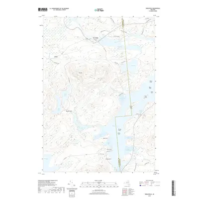
2019 Map of Piercefield
USGS Topo · Published 2019About this map
Piercefield sits at the heart of this high-resolution topographical study, where the Raquette River expands into the wide waters of Piercefield Flow and Raquette Pond. The landscape is defined by the dense water network of the Adirondack Park, featuring isolated bodies like Eagle Crag Lake and the Black Ponds tucked between significant elevations such as Arab Mtn. Local history is anchored by the settlement of Conifer and the Saint Paul Cem, while the county boundary between Franklin and St. Lawrence counties bisects the southern reaches of the pond near County Line Island. This map documents a contemporary state of these northern woodlands, showing the modern road network including State Rte 421 and various local routes like Setting Pole Dam Rd that provide access to the remote bays and points of the lakeshore.
Find a feature on this map
54 named features on this map. Tap any name to fly to it.
Don’t see what you’re looking for? This feature index may not catch every label — zoom into the map to look around manually.
Map Details
Editions of this 2019 Piercefield Map
This is the sole edition of this map. No revisions or reprints were ever made.
Other maps of this area

1904 · Long Lake
USGS Topo · 1:62,500

1905 · Saint Regis
USGS Topo · 1:62,500

1907 · Tupper Lake
USGS Topo · 1:62,500

1920 · Childwold
USGS Topo · 1:62,500

1921 · Childwold
USGS Topo · 1:48,000

1922 · Childwold
USGS Topo · 1:62,500

1948 · Ogdensburg
USGS Topo · 1:250,000

1951 · Ogdensburg
USGS Topo · 1:250,000

1953 · Ogdensburg
USGS Topo · 1:250,000

1954 · Tupper Lake
USGS Topo · 1:62,500