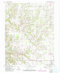
1961 Map of Pierceville
USGS Topo · Published 1993About this map
Laughery Creek and its tributaries carve a network of ridges and hollows across Ripley County, defining a rural landscape centered on the village of Pierceville. This 1961 revision, updated with 1970s and 1990s data, illustrates the persistent settlement patterns of southeastern Indiana. The map captures a transition between traditional crossroads communities like Stumke Corner and the growing municipal footprint of Milan.
Find a feature on this map
27 named features on this map. Tap any name to fly to it.
Don’t see what you’re looking for? This feature index may not catch every label — zoom into the map to look around manually.
Map Details
Editions of this 1961 Pierceville Map
Other maps of this area

1946 · Versailles
USGS Topo · 1:24,000

1946 · Milan
USGS Topo · 1:24,000

1946 · Pierceville
USGS Topo · 1:24,000

1946 · Batesville
USGS Topo · 1:24,000

1946 · Osgood
USGS Topo · 1:24,000

1946 · New Point
USGS Topo · 1:24,000

1953 · Cincinnati
USGS Topo · 1:250,000

1957 · Cincinnati
USGS Topo · 1:250,000

1958 · Spades
USGS Topo · 1:24,000

1958 · Sunman
USGS Topo · 1:24,000