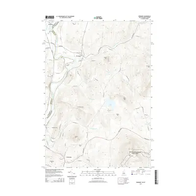
2015 Map of Piermont
USGS Topo · Published 2015About this map
Piermont and Orfordville serve as the primary settlement hubs in this New Hampshire river valley landscape, where the Connecticut River marks the border with Vermont. The terrain rises sharply from the riverbanks toward a series of prominent peaks, including Piermont Mtn, Mt Cube, and Sunday Mtn. This period shows a network of rural roads such as Lake Tarleton Rd and Piermont Heights Rd connecting scattered farmsteads and homesites. To the east, the Appalachian National Scenic Trail traverses the high ground near Blooms Mtn, illustrating the region's long-standing connection to outdoor recreation. Local history is anchored by sites like South Lawn Cem and smaller locales such as Clay Hollow. Water features define the drainage patterns of the Grafton County hills, with Eastman Brook, Archertown Brook, and Jacobs Brook carving paths through the wooded uplands toward the Connecticut valley floor.
Find a feature on this map
67 named features on this map. Tap any name to fly to it.
Don’t see what you’re looking for? This feature index may not catch every label — zoom into the map to look around manually.
Map Details
Editions of this 2015 Piermont Map
This is the sole edition of this map. No revisions or reprints were ever made.
Other maps of this area

1928 · Rumney
USGS Topo · 1:62,500

1929 · Moosilauke
USGS Topo · 1:62,500

1931 · Mt. Cube
USGS Topo · 1:62,500

1931 · Woodsville
USGS Topo · 1:48,000

1932 · Rumney
USGS Topo · 1:62,500

1932 · Moosilauke
USGS Topo · 1:62,500

1933 · Mt. Cube
USGS Topo · 1:62,500

1935 · Woodsville
USGS Topo · 1:62,500

1941 · Woodsville
USGS Topo · 1:62,500

1949 · Portland
USGS Topo · 1:250,000