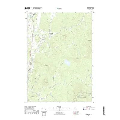
2018 Map of Piermont
USGS Topo · Published 2018About this map
Piermont and Orfordville anchor this upper Connecticut River valley landscape, where the New Hampshire and Vermont border follows the river's winding course. The topography is defined by significant elevations like Piermont Mtn and Mt Cube, with the Appalachian National Scenic Trail traversing the southeastern heights. Local genealogy is well-represented through the presence of Cedar Grove Cem and South Lawn Cem, situated near the agricultural and residential clusters of Clay Hollow. The drainage network, including Eastman Brook and Jacobs Brook, illustrates the complex watershed feeding the Connecticut River. This survey captures a mix of timbered uplands and river-plain fields, connected by a network of winding local routes like Indian Pond Rd and Piermont Height Rd.
Find a feature on this map
61 named features on this map. Tap any name to fly to it.
Don’t see what you’re looking for? This feature index may not catch every label — zoom into the map to look around manually.
Map Details
Editions of this 2018 Piermont Map
This is the sole edition of this map. No revisions or reprints were ever made.
Other maps of this area

1928 · Rumney
USGS Topo · 1:62,500

1929 · Moosilauke
USGS Topo · 1:62,500

1931 · Mt. Cube
USGS Topo · 1:62,500

1931 · Woodsville
USGS Topo · 1:48,000

1932 · Rumney
USGS Topo · 1:62,500

1932 · Moosilauke
USGS Topo · 1:62,500

1933 · Mt. Cube
USGS Topo · 1:62,500

1935 · Woodsville
USGS Topo · 1:62,500

1941 · Woodsville
USGS Topo · 1:62,500

1949 · Portland
USGS Topo · 1:250,000