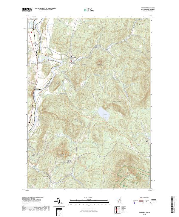
2024 Map of Piermont
USGS Topo · Published 2024About this map
The Connecticut River serves as the dividing line between Grafton County, New Hampshire, and Orange County, Vermont, shaping the agricultural and residential development of this river valley. In the town of Piermont, the landscape transitions from the fertile flats along River Rd to the high elevations of the White Mountains foothills. Local genealogy is anchored by several well-preserved burial grounds, including Cedar Grove Cem and South Lawn Cem, which sit near the intersection of Rte 10 and Eastman Brook. Further south, the community of Orfordville is nestled near Dame Hill, where researchers can find the Dame Hill Cem. The eastern portion of the quadrangle is dominated by significant peaks such as Mt Cube and Indian Pond Mtn, with the Appalachian National Scenic Trail traversing the rugged high ground near Brackett Brook. The presence of the Indian Pond Heritage Trl near Indian Pond suggests a landscape dedicated to both conservation and historical preservation.
Find a feature on this map
73 named features on this map. Tap any name to fly to it.
Don’t see what you’re looking for? This feature index may not catch every label — zoom into the map to look around manually.
Map Details
Editions of this 2024 Piermont Map
This is the sole edition of this map. No revisions or reprints were ever made.
Other maps of this area

1928 · Rumney
USGS Topo · 1:62,500

1929 · Moosilauke
USGS Topo · 1:62,500

1931 · Mt. Cube
USGS Topo · 1:62,500

1931 · Woodsville
USGS Topo · 1:48,000

1932 · Rumney
USGS Topo · 1:62,500

1932 · Moosilauke
USGS Topo · 1:62,500

1933 · Mt. Cube
USGS Topo · 1:62,500

1935 · Woodsville
USGS Topo · 1:62,500

1941 · Woodsville
USGS Topo · 1:62,500

1949 · Portland
USGS Topo · 1:250,000