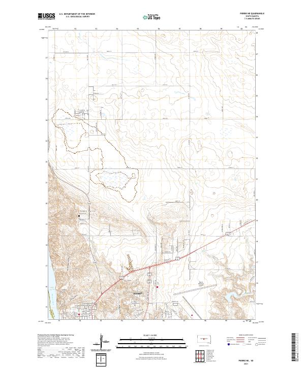
2021 Map of Pierre NE
USGS Topo · Published 2021About this map
Pierre expands northward from the banks of the Missouri River and Lake Sharpe in this modern survey. The landscape is defined by the sharp transition from the river basin to the higher plains, marked by dramatic erosion features like Monkhouse Gulch, Whiskey Gulch, and Hilgers Gulch. These natural drainages cut through the terrain toward the capital city, while the prominent Snake Butte rises as a significant landmark just north of the urban center.
Find a feature on this map
81 named features on this map. Tap any name to fly to it.
Don’t see what you’re looking for? This feature index may not catch every label — zoom into the map to look around manually.
Map Details
Editions of this 2021 Pierre NE Map
This is the sole edition of this map. No revisions or reprints were ever made.
Other maps of this area

1924 · Pierre
USGS Topo · 1:62,500

1934 · Canning
USGS Topo · 1:48,000

1937 · Canning
USGS Topo · 1:62,500

1953 · Pierre SW
USGS Topo · 1:24,000

1954 · Pierre
USGS Topo · 1:250,000

1958 · Pierre
USGS Topo · 1:250,000

1967 · Pierre NE
USGS Topo · 1:24,000

1967 · Onida SW
USGS Topo · 1:24,000
1967 · Canning NW
USGS Topo · 1:24,000
1967 · Okobojo SE
USGS Topo · 1:24,000