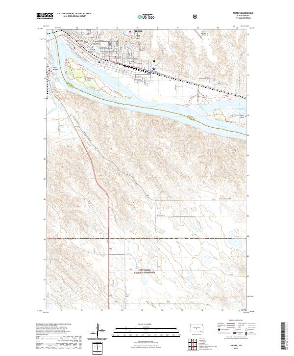
2021 Map of Pierre
USGS Topo · Published 2021About this map
Pierre and Fort Pierre sit at a geographic and political crossroads where the Missouri River is joined by the Bad River and transitions into the waters of Lake Sharpe. This survey details the state capital's civic heart, including the Hughes County Courthouse, the South Dakota Supreme Court, and the Fighting Stallions Memorial. The layout of both cities is clearly defined by the river’s path, with La Framboise Island and Farm Island providing significant riparian landmarks between the two shores. South of the urban center, the landscape opens into the expansive Fort Pierre National Grassland, characterized by rising plateaus and seasonal drainages like Antelope Cr and Gray Blanket Cr. The map also documents modern infrastructure, such as the Pierre Regional Airport and the residential expansion toward Riverside Cemetery, reflecting the continued development of this Missouri River hub.
Find a feature on this map
92 named features on this map. Tap any name to fly to it.
Don’t see what you’re looking for? This feature index may not catch every label — zoom into the map to look around manually.
Map Details
Editions of this 2021 Pierre Map
This is the sole edition of this map. No revisions or reprints were ever made.
Other maps of this area

1924 · Pierre
USGS Topo · 1:62,500

1934 · Canning
USGS Topo · 1:48,000

1937 · Canning
USGS Topo · 1:62,500

1953 · Pierre SW
USGS Topo · 1:24,000

1953 · Pierre 3 NW
USGS Topo · 1:24,000

1954 · Pierre
USGS Topo · 1:250,000

1958 · Pierre
USGS Topo · 1:250,000

1967 · Pierre NE
USGS Topo · 1:24,000
1967 · Canning NW
USGS Topo · 1:24,000

1967 · Ft. George Butte NW
USGS Topo · 1:24,000