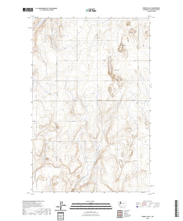
2023 Map of Piersol Hills
USGS Topo · Published 2023About this map
Piersol Hills rises as a prominent landmark in this section of the Columbia Plateau, where the high desert landscape is deeply carved by the glacial legacies of the Ice Age. The map reveals the dramatic path of Moses Coulee, a significant drainage feature that dominates the southern half of the quadrangle. High-country water features like Rummel Lake and the drainage of Middle Foster Creek punctuate the upland terrain, illustrating the complex hydrology of Douglas County. The rectilinear grid of rural routes, such as RD 14 Ne and the lengthy Leahy-Mansfield-Mayfield Rd NE, highlights the agricultural and ranching infrastructure that spans these elevations. Distinctive geologic formations including Hook Hills, Wheeler Hills, and the singular Yeager Rock provide critical navigational points for local residents and land managers alike.
Find a feature on this map
21 named features on this map. Tap any name to fly to it.
Don’t see what you’re looking for? This feature index may not catch every label — zoom into the map to look around manually.
Map Details
Editions of this 2023 Piersol Hills Map
This is the sole edition of this map. No revisions or reprints were ever made.
Other maps of this area

1953 · Ritzville
USGS Topo · 1:250,000

1959 · Ritzville
USGS Topo · 1:250,000

1965 · Ritzville
USGS Topo · 1:250,000

1965 · St. Andrews
USGS Topo · 1:24,000

1965 · Jameson Lake West
USGS Topo · 1:24,000

1965 · Jameson Lake East
USGS Topo · 1:24,000

1968 · Chief Joseph Dam
USGS Topo · 1:24,000

1968 · Coleman Hill
USGS Topo · 1:24,000
1968 · Barnes Butte
USGS Topo · 1:24,000
1968 · Leahy
USGS Topo · 1:24,000