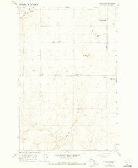
1968 Map of Piersol Hills
USGS Topo · Published 1971About this map
Moses Coulee dominates the southern reaches of this landscape, its deep trench-like form providing a stark contrast to the higher ground of the Piersol Hills and Wheeler Hills. In the late 1960s, this portion of Douglas County maintained a distinctly rural character, with small settlements like Buckingham Grove and Badger Wells situated near water sources such as Buckingham Creek. The presence of Fairview School along Fairview Road indicates a established community hub amidst the scattered farmsteads and agricultural infrastructure.
Find a feature on this map
23 named features on this map. Tap any name to fly to it.
Don’t see what you’re looking for? This feature index may not catch every label — zoom into the map to look around manually.
Map Details
Editions of this 1968 Piersol Hills Map
This is the sole edition of this map. No revisions or reprints were ever made.
Other maps of this area

1953 · Ritzville
USGS Topo · 1:250,000

1959 · Ritzville
USGS Topo · 1:250,000

1965 · Ritzville
USGS Topo · 1:250,000

1965 · St. Andrews
USGS Topo · 1:24,000

1965 · Jameson Lake West
USGS Topo · 1:24,000

1965 · Jameson Lake East
USGS Topo · 1:24,000

1968 · Chief Joseph Dam
USGS Topo · 1:24,000

1968 · Coleman Hill
USGS Topo · 1:24,000
1968 · Barnes Butte
USGS Topo · 1:24,000
1968 · Leahy
USGS Topo · 1:24,000