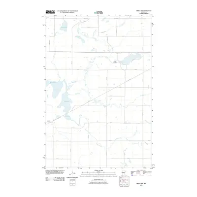
2010 Map of Pierz Lake
USGS Topo · Published 2010About this map
Vawter sits along the southwestern edge of this landscape, positioned where the historical rail corridor now known as the Soo Line Trl cuts across the terrain. The area is defined by a dense network of water bodies and meandering streams, including Pelkey Lake, Frieze Lake, and the larger Pierz Lake, which is regulated by the Pierz Lake Dam. These wetlands and lakes are interconnected by a complex drainage system featuring the Platte River, Skunk River, and several smaller tributaries like Little Mink Creek and Buckman Creek. The township-and-range grid is heavily etched into the land by a series of local roads, such as Agram Blvd and Kettle Rd, reflecting the rural agricultural character of this part of Morrison County. Researchers will find a detailed representation of the 21st-century rural infrastructure and the preservation of natural waterways in this central Minnesota region.
Find a feature on this map
41 named features on this map. Tap any name to fly to it.
Don’t see what you’re looking for? This feature index may not catch every label — zoom into the map to look around manually.
Map Details
Editions of this 2010 Pierz Lake Map
This is the sole edition of this map. No revisions or reprints were ever made.
Other maps of this area

1948 · Belle Prairie
USGS Topo · 1:62,500

1948 · Pierz
USGS Topo · 1:62,500

1948 · Lastrup
USGS Topo · 1:62,500

1948 · Little Falls
USGS Topo · 1:62,500

1950 · Lastrup
USGS Topo · 1:62,500

1950 · Belle Prairie
USGS Topo · 1:62,500

1950 · Little Falls
USGS Topo · 1:62,500

1950 · Pierz
USGS Topo · 1:62,500

1953 · Brainerd
USGS Topo · 1:250,000

1953 · Saint Cloud
USGS Topo · 1:250,000