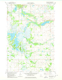
1978 Map of Pierz Lake
USGS Topo · Published 1978About this map
Glacial lake basins and riparian wetlands dominate this landscape in eastern Morrison County, where the Rice-Skunk Lake State Wildlife Management Area encompasses much of the low-lying terrain. The hydrography, compiled with information from the Minnesota Department of Natural Resources, reveals a complex network of interconnected water bodies including Little Rock Lake, Skunk Lake, and Mud Lake. The winding Platte River cuts through the center of the sheet, while the smaller Pierz Lake is situated to the east near a public Boat Ramp.
Find a feature on this map
29 named features on this map. Tap any name to fly to it.
Don’t see what you’re looking for? This feature index may not catch every label — zoom into the map to look around manually.
Map Details
Editions of this 1978 Pierz Lake Map
This is the sole edition of this map. No revisions or reprints were ever made.
Other maps of this area

1948 · Belle Prairie
USGS Topo · 1:62,500

1948 · Pierz
USGS Topo · 1:62,500

1948 · Lastrup
USGS Topo · 1:62,500

1948 · Little Falls
USGS Topo · 1:62,500

1950 · Lastrup
USGS Topo · 1:62,500

1950 · Belle Prairie
USGS Topo · 1:62,500

1950 · Little Falls
USGS Topo · 1:62,500

1950 · Pierz
USGS Topo · 1:62,500

1953 · Brainerd
USGS Topo · 1:250,000

1953 · Saint Cloud
USGS Topo · 1:250,000