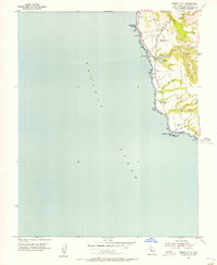
1955 Map of Pigeon Point
USGS Topo · Published 1956About this map
The Pigeon Point Light Station stands as the primary maritime landmark on this mid-century coastal survey of San Mateo County. Along the shore, the Old Coast Road traces the rugged bluff line, connecting notable geographical features such as Pebble Beach and Bean Hollow Beach. The inland terrain is defined by the significant rise of Butano Mesa and the drainage of Arroyo de los Frijoles into Lake Lucerne.
Find a feature on this map
23 named features on this map. Tap any name to fly to it.
Don’t see what you’re looking for? This feature index may not catch every label — zoom into the map to look around manually.
Map Details
Editions of this 1955 Pigeon Point Map
3 editions found
Other maps of this area

1902 · Santa Cruz
USGS Topo · 1:125,000

1940 · Halfmoon Bay
USGS Topo · 1:62,500

1940 · Ano Nuevo
USGS Topo · 1:62,500

1941 · Ano Nuevo Pt.
USGS Topo · 1:62,500

1942 · Ano Nuevo
USGS Topo · 1:62,500

1943 · Halfmoon Bay
USGS Topo · 1:62,500

1947 · San Francisco
USGS Topo · 1:250,000

1948 · San Francisco
USGS Topo · 1:250,000

1948 · Ano Nuevo
USGS Topo · 1:62,500

1955 · San Francisco
USGS Topo · 1:250,000