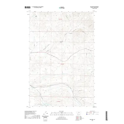
2020 Map of Pike Creek
USGS Topo · Published 2020About this map
Big Spring and Castle Spring emerge from the complex hydrology of Fergus County, forming the headwaters for a network of drainages that define this central Montana landscape. The southern portion of the quadrangle is dominated by the system of Big Spring Cr and E Fork Big Spring Cr, where Fish Hatchery Rd suggests a specialized use of these clear water sources. To the north, the terrain transitions into a series of distinctive landforms including Limekiln Canyon and the prominent Kelly Hill. Historical transportation routes are evident in the presence of the Gilt Edge Stage Rd, which cuts across the drainage of Ruby Gulch and Boyd Cr. The map details a transition from the lower creek bottoms to the more elevated features of Blind Breed Gulch, capturing the rural character and water-dependent geography of the region.
Find a feature on this map
73 named features on this map. Tap any name to fly to it.
Don’t see what you’re looking for? This feature index may not catch every label — zoom into the map to look around manually.
Map Details
Editions of this 2020 Pike Creek Map
This is the sole edition of this map. No revisions or reprints were ever made.
Other maps of this area
1889 · Big Snowy Mountain
USGS Topo · 1:250,000
1893 · Big Snowy Mountain
USGS Topo · 1:250,000
1941 · Lewistown
USGS Topo · 1:62,500
1941 · Judith Peak
USGS Topo · 1:62,500
1944 · Lewistown
USGS Topo · 1:62,500
1944 · Judith Peak
USGS Topo · 1:62,500

1954 · Roundup
USGS Topo · 1:250,000

1954 · Lewistown
USGS Topo · 1:250,000

1958 · Roundup
USGS Topo · 1:250,000

1959 · Lewistown
USGS Topo · 1:250,000