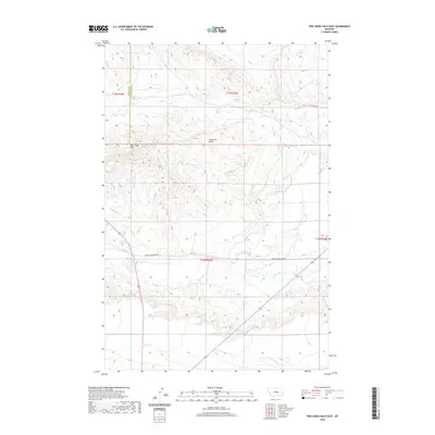
2020 Map of Pike Creek Hills East
USGS Topo · Published 2020About this map
Pike Creek Hills dominate the western portion of this Central Montana landscape, marking the high ground between the drainage basins of several significant local waterways. The map illustrates the sparsely settled character of the region where the borders of Fergus County and Petroleum County meet. Most of the terrain is defined by the winding paths of Flatwillow Creek, which flows eastward through the center of the sheet, and Little Wall Creek in the south. Higher elevations are characterized by features like Lamberts Bench, overlooking the northern drainage of Pike Creek. Access to this remote rangeland is provided by gravel routes such as Pike Creek Road and Upper Flatwillow Road, reflecting a landscape dedicated primarily to ranching and natural drainage patterns.
Find a feature on this map
12 named features on this map. Tap any name to fly to it.
Don’t see what you’re looking for? This feature index may not catch every label — zoom into the map to look around manually.
Map Details
Editions of this 2020 Pike Creek Hills East Map
This is the sole edition of this map. No revisions or reprints were ever made.
Other maps of this area

1954 · Roundup
USGS Topo · 1:250,000

1958 · Roundup
USGS Topo · 1:250,000

1986 · Snoose Creek
USGS Topo · 1:24,000

1986 · Pike Creek Hills West
USGS Topo · 1:24,000

1986 · Lake Mason NE
USGS Topo · 1:24,000

1986 · Lake Mason NW
USGS Topo · 1:24,000

1986 · Flatwillow
USGS Topo · 1:24,000

1986 · Pike Creek Hills East
USGS Topo · 1:24,000

1986 · Big Wall NW
USGS Topo · 1:24,000

1986 · Milk Springs
USGS Topo · 1:24,000