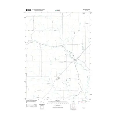
2013 Map of Pike
USGS Topo · Published 2013About this map
Wiscoy Creek and its many tributaries, including Emory Brook and Bush Brook, define the drainage and settlement patterns of this corner of Wyoming and Allegany Counties. The village of Pike serves as a primary hub, situated near the confluence of local waterways with streets like Canal Street and Main Street marking its historic core. Rural life is reflected in the numerous named family-related sites and cemeteries, such as the Lyonsburg Cemetery and the Neal Family Farm, which provide essential touchstones for local genealogists. The presence of recreational and agricultural landmarks like Camp Sam Wood and Wiscoy Farms indicates a landscape where traditional farming and youth camping have long coexisted. Further out, small crossroads like Hardys, Howes, and Wing emphasize the dispersed nature of the community as it appeared in the early 21st century.
Find a feature on this map
70 named features on this map. Tap any name to fly to it.
Don’t see what you’re looking for? This feature index may not catch every label — zoom into the map to look around manually.
Map Details
Editions of this 2013 Pike Map
This is the sole edition of this map. No revisions or reprints were ever made.
Other maps of this area

1905 · Portage
USGS Topo · 1:62,500

1906 · Angelica
USGS Topo · 1:62,500

1923 · Arcade
USGS Topo · 1:62,500

1924 · Franklinville
USGS Topo · 1:62,500

1925 · Arcade
USGS Topo · 1:62,500

1941 · Angelica
USGS Topo · 1:62,500

1942 · Franklinville
USGS Topo · 1:62,500

1943 · Warsaw
USGS Topo · 1:24,000

1943 · Castile
USGS Topo · 1:24,000

1943 · Portageville
USGS Topo · 1:24,000