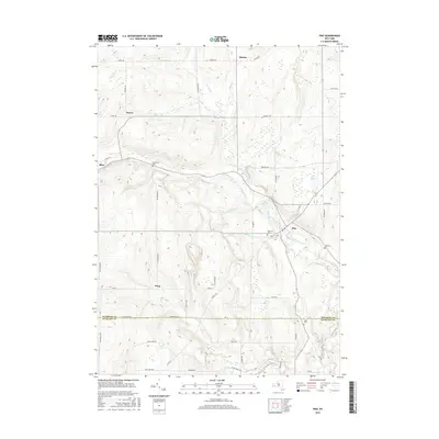
2016 Map of Pike
USGS Topo · Published 2016About this map
Pike and Bliss anchor this rural landscape where the border of Wyoming and Allegany Counties meets in western New York. The terrain is defined by the winding course of Wiscoy Creek, which receives several tributaries including Spring Brook, Bush Brook, and Emory Brook. Small clusters of settlement like Wing, Hardys, and Howes are connected by a network of local roads such as Lyonsburg Rd and Jablonski Rd.
Find a feature on this map
51 named features on this map. Tap any name to fly to it.
Don’t see what you’re looking for? This feature index may not catch every label — zoom into the map to look around manually.
Map Details
Editions of this 2016 Pike Map
This is the sole edition of this map. No revisions or reprints were ever made.
Other maps of this area

1905 · Portage
USGS Topo · 1:62,500

1906 · Angelica
USGS Topo · 1:62,500

1923 · Arcade
USGS Topo · 1:62,500

1924 · Franklinville
USGS Topo · 1:62,500

1925 · Arcade
USGS Topo · 1:62,500

1941 · Angelica
USGS Topo · 1:62,500

1942 · Franklinville
USGS Topo · 1:62,500

1943 · Warsaw
USGS Topo · 1:24,000

1943 · Castile
USGS Topo · 1:24,000

1943 · Portageville
USGS Topo · 1:24,000