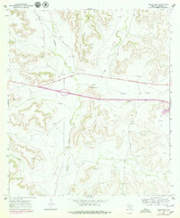
1967 Map of Pikes Peak
USGS Topo · Published 1979About this map
Pikes Peak rises above the arid plateau of West Texas, anchoring a landscape defined by seasonal drainages and livestock ranching. This 1967 survey, with revisions from the late 1970s, illustrates the sparse settlement of Crockett County, where large holdings like the Bunger Ranch and Clayton Ranch manage the scrub-covered terrain. The topography is etched by ancient watercourses such as Howard Draw, Peak Draw, and Eureka Draw, which only carry water during heavy rains.
Find a feature on this map
13 named features on this map. Tap any name to fly to it.
Don’t see what you’re looking for? This feature index may not catch every label — zoom into the map to look around manually.
Map Details
Editions of this 1967 Pikes Peak Map
2 editions found
Other maps of this area

1929 · Sheffield
USGS Topo · 1:125,000

1954 · Sonora
USGS Topo · 1:250,000

1958 · Sonora
USGS Topo · 1:250,000

1967 · Owens Creek SE
USGS Topo · 1:24,000

1967 · Burnt Canyon
USGS Topo · 1:24,000

1967 · Pikes Peak
USGS Topo · 1:24,000
1967 · Schneeman Draw SW
USGS Topo · 1:24,000

1967 · Hunt Ranch
USGS Topo · 1:24,000

1967 · Bachelor Hill
USGS Topo · 1:24,000
1967 · Schneeman Draw SE
USGS Topo · 1:24,000