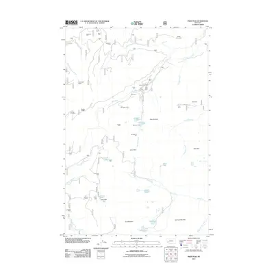
2011 Map of Pikes Peak
USGS Topo · Published 2011About this map
Master Mining Camp and a dense concentration of mineral extraction sites define this high-elevation region of Granite County. The landscape is etched with the history of the Montana gold rush, from the Gold Creek Placer Mine to the hard-rock operations at Eureka Ridge Mine and Brooklyn Mine. This era of industry is supported by a network of high-country water management, most notably at the Gold Lake Dam, which regulates the flow from Gold Creek Lakes into the wider drainage system.
Find a feature on this map
56 named features on this map. Tap any name to fly to it.
Don’t see what you’re looking for? This feature index may not catch every label — zoom into the map to look around manually.
Map Details
Editions of this 2011 Pikes Peak Map
This is the sole edition of this map. No revisions or reprints were ever made.
Other maps of this area

1889 · Helena
USGS Topo · 1:250,000

1893 · Helena
USGS Topo · 1:250,000

1899 · Helena
USGS Topo · 1:250,000

1903 · Helena
USGS Topo · 1:250,000

1908 · Philipsburg
USGS Topo · 1:125,000

1919 · Drummond
USGS Topo · 1:125,000

1921 · Drummond
USGS Topo · 1:125,000

1947 · Butte
USGS Topo · 1:250,000

1958 · Butte
USGS Topo · 1:250,000

1958 · Drummond
USGS Topo · 1:62,500