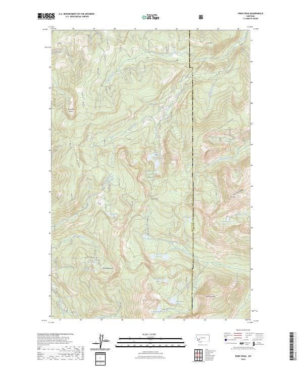
2024 Map of Pikes Peak
USGS Topo · Published 2024About this map
Deerlodge National Forest encompasses the high-elevation terrain of the Flint Creek Range in this modern topographic study, where the boundary between Granite and Powell counties follows the continental divide. The landscape is defined by a series of peaks and ridges, including Pikes Peak and its namesake Pikes Peak Ridge, which separate the various drainage basins. A complex network of alpine lakes, such as Bielenberg Lake, Tolean Lake, and the Dolus Lakes, feed into creek systems like Gold Creek and Rock Creek.
Find a feature on this map
57 named features on this map. Tap any name to fly to it.
Don’t see what you’re looking for? This feature index may not catch every label — zoom into the map to look around manually.
Map Details
Editions of this 2024 Pikes Peak Map
This is the sole edition of this map. No revisions or reprints were ever made.
Other maps of this area

1889 · Helena
USGS Topo · 1:250,000

1893 · Helena
USGS Topo · 1:250,000

1899 · Helena
USGS Topo · 1:250,000

1903 · Helena
USGS Topo · 1:250,000

1908 · Philipsburg
USGS Topo · 1:125,000

1919 · Drummond
USGS Topo · 1:125,000

1921 · Drummond
USGS Topo · 1:125,000

1947 · Butte
USGS Topo · 1:250,000

1958 · Butte
USGS Topo · 1:250,000

1958 · Drummond
USGS Topo · 1:62,500