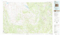
1983 Map of Pikes Peak
USGS Topo · Published 1983About this map
Cripple Creek and the high-elevation mining district represent the industrious heart of this early 1980s landscape. The map reveals the intricate network of historic claims and settlements that defined the Gold Belt, including Victor, Altman, and Goldfield. Significant industrial operations like the Stratton Mine and Vindicator Mine are plotted alongside the complex topography of Bull Hill and Beacon Hill.
Find a feature on this map
69 named features on this map. Tap any name to fly to it.
Don’t see what you’re looking for? This feature index may not catch every label — zoom into the map to look around manually.
Map Details
Editions of this 1983 Pikes Peak Map
This is the sole edition of this map. No revisions or reprints were ever made.
Other maps of this area

1889 · Canon City
USGS Topo · 1:125,000

1889 · Leadville
USGS Topo · 1:125,000

1891 · Pueblo
USGS Topo · 1:125,000

1891 · Leadville
USGS Topo · 1:125,000

1892 · Canon City
USGS Topo · 1:125,000

1893 · Platte Canyon
USGS Topo · 1:125,000

1893 · Colorado Springs
USGS Topo · 1:125,000

1894 · Pikes Peak
USGS Topo · 1:125,000

1894 · Castle Rock
USGS Topo · 1:125,000

1894 · Pueblo
USGS Topo · 1:125,000