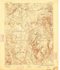
1894 Map of Pikes Peak
USGS Topo · Published 1896About this map
Cripple Creek sits at the heart of this survey, surrounded by the high-elevation mining claims of Globe Hill, Raven Hill, and Bull Mt. during a period of intense industrial activity. This landscape is defined by the sudden growth of mining camps and the infrastructure required to support them, including a Stamp Mill and the steel rails of the Colorado Midland Railroad. The topography is exceptionally detailed, tracing the steep gulches where gold was sought, such as Poverty Gulch and Arequa Gulch.
Find a feature on this map
104 named features on this map. Tap any name to fly to it.
Don’t see what you’re looking for? This feature index may not catch every label — zoom into the map to look around manually.
Map Details
Editions of this 1894 Pikes Peak Map
2 editions found
Other maps of this area

1889 · Canon City
USGS Topo · 1:125,000

1891 · Pueblo
USGS Topo · 1:125,000

1892 · Canon City
USGS Topo · 1:125,000

1893 · Platte Canyon
USGS Topo · 1:125,000

1893 · Colorado Springs
USGS Topo · 1:125,000

1894 · Pikes Peak
USGS Topo · 1:125,000

1894 · Castle Rock
USGS Topo · 1:125,000

1894 · Pueblo
USGS Topo · 1:125,000

1896 · Pueblo
USGS Topo · 1:125,000

1897 · Pueblo
USGS Topo · 1:125,000