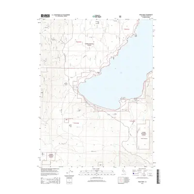
2015 Map of Pikes Point
USGS Topo · Published 2015About this map
Eagle Lake dominates the central landscape of this Lassen County region, its western shoreline defined by a series of prominent geographic markers including Wildcat Point, Pikes Point, and Slough Point. The eastern edge of the Lassen National Forest meets the water here, where the geography shifts from the volcanic Brockman Flat Lava Beds in the north to the expansive meadows of Papoose Meadows in the south. The area’s recreational and access infrastructure is concentrated along the southern shore near Gallatin Beach, serviced by Gallatin Rd and Eagle Lake Rd. Inland, the terrain rises toward Merrill Mtn, surrounded by a series of high-elevation basins such as Little Merrill Flat and Big Merrill Flat, which characterize the high-country landscape typical of the northeastern California interior.
Find a feature on this map
32 named features on this map. Tap any name to fly to it.
Don’t see what you’re looking for? This feature index may not catch every label — zoom into the map to look around manually.
Map Details
Editions of this 2015 Pikes Point Map
This is the sole edition of this map. No revisions or reprints were ever made.
Other maps of this area
1886 · Honey Lake
USGS Topo · 1:250,000
1891 · Honey Lake
USGS Topo · 1:250,000
1893 · Honey Lake
USGS Topo · 1:250,000
1954 · Susanville
USGS Topo · 1:62,500
1954 · Fredonyer Peak
USGS Topo · 1:62,500
1955 · Westwood
USGS Topo · 1:62,500
1955 · Westwood
USGS Topo · 1:250,000
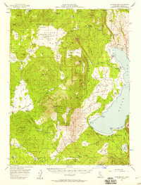
1956 · Antelope Mtn
USGS Topo · 1:62,500
1958 · Westwood
USGS Topo · 1:250,000
1959 · Westwood
USGS Topo · 1:250,000