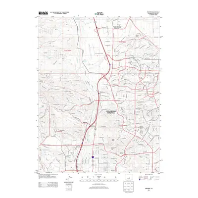
2013 Map of Pikeview
USGS Topo · Published 2013About this map
Pikeview and Papeton sit along the northern edge of Colorado Springs during this period of significant urban and institutional development. The map details the transition from ranching lands like Wilsons Ranch and Flying W Ranch to modern academic campuses, including the USAF Academy Airfield and several satellite university facilities. The landscape is defined by the dramatic relief of Austin Bluffs, Popes Bluffs, and the landmark Pulpit Rock. Water management is prominent through features like the Templeton Gap Floodway and the Mesa Number 1 Reservoir. Genealogists may find interest in the documented locations of Capps Cem and Mt Saint Francis Cem, which remain as markers of the area's earlier settlement history amidst the growing suburbs of Woodmen Valley and Hunters Hill.
Find a feature on this map
270 named features on this map. Tap any name to fly to it.
Don’t see what you’re looking for? This feature index may not catch every label — zoom into the map to look around manually.
Map Details
Editions of this 2013 Pikeview Map
This is the sole edition of this map. No revisions or reprints were ever made.
Other maps of this area

1893 · Colorado Springs
USGS Topo · 1:125,000

1894 · Castle Rock
USGS Topo · 1:125,000

1909 · Colorado Springs
USGS Topo · 1:125,000

1913 · Castle Rock
USGS Topo · 1:125,000

1940 · Elbert
USGS Topo · 1:62,500

1942 · Colorado Springs
USGS Topo · 1:125,000

1944 · Elbert
USGS Topo · 1:62,500

1948 · Manitou Springs
USGS Topo · 1:24,000

1948 · Colorado Springs
USGS Topo · 1:62,500

1948 · Pikeview
USGS Topo · 1:24,000
Featured Places
- Colorado Springs, CO
- Pikeview, Colorado Springs
- Papeton, Colorado Springs
- El Paso County, CO
- United States