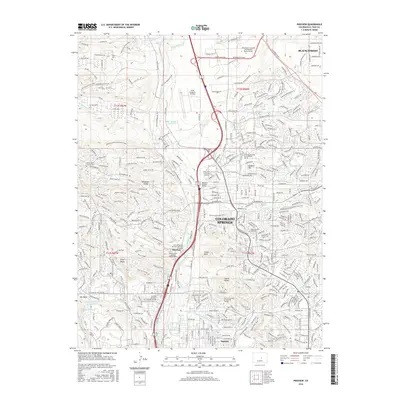
2016 Map of Pikeview
USGS Topo · Published 2016About this map
The USAF Academy Airfield and the sprawling northern suburbs of Colorado Springs define this modern landscape, where academic institutions and residential developments have rapidly transformed the foothills. This 2016 survey shows a high concentration of educational centers, including the University of Colorado at Colorado Springs and Regis University, interwoven with significant terrain features like Austin Bluffs and Pulpit Rock. Smaller, historically distinct pockets such as Papeton and Pikeview remain labeled, providing a bridge between the area's early 20th-century origins and its current status as a major urban hub. The map carefully tracks the complex drainage systems of Cottonwood Creek and the Templeton Gap Floodway, which are critical to managing water flow through this high-altitude environment along the Eastern Slope.
Find a feature on this map
380 named features on this map. Tap any name to fly to it.
Don’t see what you’re looking for? This feature index may not catch every label — zoom into the map to look around manually.
Map Details
Editions of this 2016 Pikeview Map
This is the sole edition of this map. No revisions or reprints were ever made.
Other maps of this area

1893 · Colorado Springs
USGS Topo · 1:125,000

1894 · Castle Rock
USGS Topo · 1:125,000

1909 · Colorado Springs
USGS Topo · 1:125,000

1913 · Castle Rock
USGS Topo · 1:125,000

1940 · Elbert
USGS Topo · 1:62,500

1942 · Colorado Springs
USGS Topo · 1:125,000

1944 · Elbert
USGS Topo · 1:62,500

1948 · Manitou Springs
USGS Topo · 1:24,000

1948 · Colorado Springs
USGS Topo · 1:62,500

1948 · Pikeview
USGS Topo · 1:24,000
Featured Places
- Colorado Springs, CO
- Pikeview, Colorado Springs
- Papeton, Colorado Springs
- El Paso County, CO
- United States