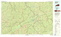
1977 Map of Pikeville
USGS Topo · Published 1983About this map
Pikeville and the deep valleys of the Cumberland Plateau define this 1970s landscape, where the borders of Kentucky, Virginia, and Tennessee converge. The terrain is dominated by the long ridge of Pine Mountain, which serves as a natural barrier between the coalfields and the Jefferson National Forest. This era shows a region shaped by its river systems and industrial rail lines, with the C & O and L & N railroads following the winding paths of the Levisa Fork and Russell Fork.
Find a feature on this map
107 named features on this map. Tap any name to fly to it.
Don’t see what you’re looking for? This feature index may not catch every label — zoom into the map to look around manually.
Map Details
Editions of this 1977 Pikeville Map
This is the sole edition of this map. No revisions or reprints were ever made.
Other maps of this area

1886 · Prestonsburg
USGS Topo · 1:125,000

1886 · Grundy
USGS Topo · 1:125,000

1887 · Jonesville
USGS Topo · 1:125,000

1887 · Warfield
USGS Topo · 1:125,000

1889 · Salyersville
USGS Topo · 1:125,000

1890 · Whitesburg
USGS Topo · 1:125,000

1890 · Grundy
USGS Topo · 1:125,000

1891 · Tazewell
USGS Topo · 1:125,000

1891 · Hazard
USGS Topo · 1:125,000

1891 · Oceana
USGS Topo · 1:125,000