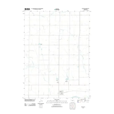
2011 Map of Pilger
USGS Topo · Published 2011About this map
The village of Pilger sits along the northern banks of the Elkhorn River in this 2011 survey of Stanton County. The landscape is defined by a grid-like agricultural road network and several notable water management features, including Willers Reservoir and Bordner Reservoir. These reservoirs, along with the Pilger Reservoir 1-B, illustrate the critical role of water control in this plains environment. Local history is anchored by the Pilger Post Office and the Pilger Cemetery, while the northern terrain is drained by meandering tributaries like Plum Creek and Sand Creek. The inclusion of Black Hills Trail Rd provides a link to regional transit corridors passing through the settlement, which serves as a central hub for the surrounding rural sections.
Find a feature on this map
35 named features on this map. Tap any name to fly to it.
Don’t see what you’re looking for? This feature index may not catch every label — zoom into the map to look around manually.
Map Details
Editions of this 2011 Pilger Map
This is the sole edition of this map. No revisions or reprints were ever made.
Other maps of this area

1955 · Sioux City
USGS Topo · 1:250,000

1955 · Fremont
USGS Topo · 1:250,000

1957 · Fremont
USGS Topo · 1:250,000

1958 · Sioux City
USGS Topo · 1:250,000

1958 · Fremont
USGS Topo · 1:250,000

1959 · Sioux City
USGS Topo · 1:250,000

1963 · Pilger
USGS Topo · 1:24,000

1963 · Wayne SW
USGS Topo · 1:24,000

1963 · Wisner
USGS Topo · 1:24,000

1963 · Altona
USGS Topo · 1:24,000