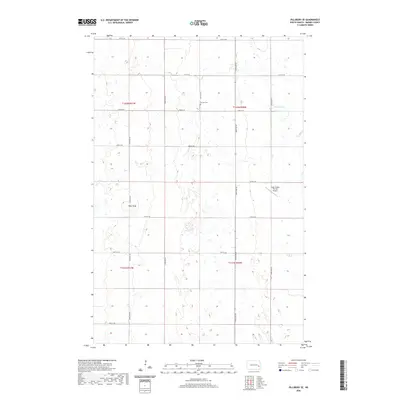
2020 Map of Pillsbury SE
USGS Topo · Published 2020About this map
Morton Cem serves as a silent witness to the early families of Noltimier Township, situated among the sections of this Barnes County landscape. The terrain is defined by the high ground of Pilot Knob, which overlooks a dense network of seasonal wetlands and prairie potholes that characterize the Red River Valley upland. Agriculture and aviation intersect at the Gage Flying Farmer Airport, reflecting a mid-century trend of private airstrips integrated directly into the rural farming economy.
Find a feature on this map
21 named features on this map. Tap any name to fly to it.
Don’t see what you’re looking for? This feature index may not catch every label — zoom into the map to look around manually.
Map Details
Editions of this 2020 Pillsbury SE Map
This is the sole edition of this map. No revisions or reprints were ever made.
Other maps of this area

1897 · Tower
USGS Topo · 1:125,000

1952 · Grand Forks
USGS Topo · 1:250,000

1953 · Fargo
USGS Topo · 1:250,000

1956 · Fargo
USGS Topo · 1:250,000

1956 · Grand Forks
USGS Topo · 1:250,000

1961 · Valley City East
USGS Topo · 1:24,000

1966 · Grand Forks
USGS Topo · 1:250,000

1967 · Tower City
USGS Topo · 1:24,000

1967 · Pillsbury SE
USGS Topo · 1:24,000
1967 · Pillsbury SW
USGS Topo · 1:24,000
Featured Places
- Noltimier Township, ND
- Grand Prairie Township, ND
- Minnie Lake Township, ND
- Weimer Township, ND
- Barnes County, ND