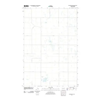
2011 Map of Pillsbury SW
USGS Topo · Published 2011About this map
Glacial depressions and prairie potholes define this section of Noltimier Township, where the landscape is dominated by scattered wetlands and intermittent water bodies. Central to this area is the expansive Larson Slough, a significant hydrologic feature that transitions into a network of smaller ponds and marshy pockets. Further north, Crow Lake stands as a distinct landmark amidst the systematic grid of rural roads. This 2011 survey by the U.S. Geological Survey shows a strictly maintained section-line road network, including 121st Ave SE and 26th St SE, which provide the primary access to these agricultural lands. The map reflects the enduring land-use patterns of Barnes County, where the topography dictates the placement of fields around the naturally occurring sloughs and basins typical of the region.
Find a feature on this map
17 named features on this map. Tap any name to fly to it.
Don’t see what you’re looking for? This feature index may not catch every label — zoom into the map to look around manually.
Map Details
Editions of this 2011 Pillsbury SW Map
This is the sole edition of this map. No revisions or reprints were ever made.
Other maps of this area

1897 · Tower
USGS Topo · 1:125,000

1897 · Eckelson
USGS Topo · 1:125,000

1952 · Grand Forks
USGS Topo · 1:250,000

1952 · New Rockford
USGS Topo · 1:250,000

1953 · Jamestown
USGS Topo · 1:250,000

1953 · Fargo
USGS Topo · 1:250,000

1956 · New Rockford
USGS Topo · 1:250,000

1956 · Fargo
USGS Topo · 1:250,000

1956 · Jamestown
USGS Topo · 1:250,000

1956 · Grand Forks
USGS Topo · 1:250,000
Featured Places
- Noltimier Township, ND
- Grand Prairie Township, ND
- Getchell Township, ND
- Ashtabula Township, ND
- Barnes County, ND