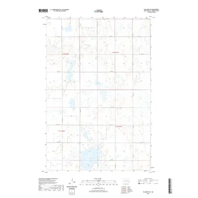
2020 Map of Pillsbury SW
USGS Topo · Published 2020About this map
Glacial depressions and prairie potholes define this section of the Sheyenne River valley uplands in North Dakota. The landscape is characterized by significant water bodies such as Crow Lake and the marshy expanses of Larson Slough and Adams Slough. These features are vital components of the regional hydrography, set within a strictly gridded section-line road network that facilitates the agricultural movement of this prairie region. Modern infrastructure, including Co Hwy 27 and local routes like 120th Ave SE, provides the framework for navigating the townships of T142N R58W and T141N R57W. The map captures the subtle elevation changes of the Great Plains, where small, unnamed wetlands dot the terrain between established section roads like 20th St SE and 28th St SE.
Find a feature on this map
20 named features on this map. Tap any name to fly to it.
Don’t see what you’re looking for? This feature index may not catch every label — zoom into the map to look around manually.
Map Details
Editions of this 2020 Pillsbury SW Map
This is the sole edition of this map. No revisions or reprints were ever made.
Other maps of this area

1897 · Tower
USGS Topo · 1:125,000

1897 · Eckelson
USGS Topo · 1:125,000

1952 · Grand Forks
USGS Topo · 1:250,000

1952 · New Rockford
USGS Topo · 1:250,000

1953 · Jamestown
USGS Topo · 1:250,000

1953 · Fargo
USGS Topo · 1:250,000

1956 · New Rockford
USGS Topo · 1:250,000

1956 · Fargo
USGS Topo · 1:250,000

1956 · Jamestown
USGS Topo · 1:250,000

1956 · Grand Forks
USGS Topo · 1:250,000
Featured Places
- Noltimier Township, ND
- Grand Prairie Township, ND
- Getchell Township, ND
- Ashtabula Township, ND
- Barnes County, ND