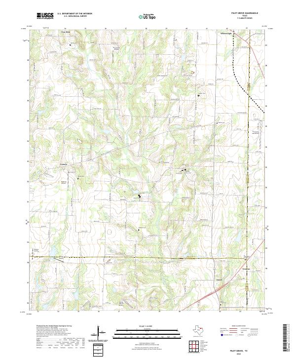
2022 Map of Pilot Grove
USGS Topo · Published 2022About this map
Pilot Grove Creek and its many branches form the central drainage system of this rural landscape, where the borders of Grayson, Fannin, and Collin counties converge. The area is characterized by a high density of small family and community burial grounds, including the Warden Cem, Luper Cem, and the Old Pilot Grove Cem, providing a rich resource for genealogical research. While settlements like Tom Bean, Whitewright, and Trenton anchor the periphery, the central portion of the map is defined by agricultural lands and several small aviation facilities such as Tilghman Airport and the Flying T Ranch Airport. The mapping of features like Whippoorwill Canyon and Knob Hill Road alongside established routes like FM 2729 illustrates a persistent pattern of rural development that respects the underlying creek-cut topography.
Find a feature on this map
137 named features on this map. Tap any name to fly to it.
Don’t see what you’re looking for? This feature index may not catch every label — zoom into the map to look around manually.
Map Details
Editions of this 2022 Pilot Grove Map
This is the sole edition of this map. No revisions or reprints were ever made.
Other maps of this area

1901 · Denison
USGS Topo · 1:125,000

1954 · Sherman
USGS Topo · 1:250,000

1958 · Whitesright
USGS Topo · 1:62,500

1958 · Sherman
USGS Topo · 1:250,000

1958 · Sherman
USGS Topo · 1:62,500

1958 · Howe
USGS Topo · 1:24,000

1960 · Blue Ridge
USGS Topo · 1:24,000

1960 · Pike
USGS Topo · 1:24,000

1961 · Van Alstyne
USGS Topo · 1:24,000
1961 · Anna
USGS Topo · 1:24,000