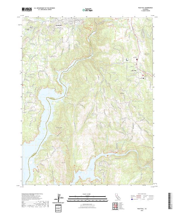
2022 Map of Pilot Hill
USGS Topo · Published 2022About this map
Auburn and Pilot Hill anchor this transition between the rising foothills of the Sierra Nevada and the expanding Central Valley. The landscape is defined by the significant hydrological engineering of the Newcastle Canal and Boardman Canal, which cut across the north near Mormon Ravine. To the south, the waters of Folsom Lake fill the deep drainages of the American River, reaching toward the site of Salmon Falls.
Find a feature on this map
155 named features on this map. Tap any name to fly to it.
Don’t see what you’re looking for? This feature index may not catch every label — zoom into the map to look around manually.
Map Details
Editions of this 2022 Pilot Hill Map
This is the sole edition of this map. No revisions or reprints were ever made.
Other maps of this area

1891 · Sacramento
USGS Topo · 1:125,000

1891 · Placerville
USGS Topo · 1:125,000

1892 · Sacramento
USGS Topo · 1:125,000

1892 · Placerville
USGS Topo · 1:125,000

1893 · Placerville
USGS Topo · 1:125,000

1893 · Sacramento
USGS Topo · 1:125,000

1914 · Folsom
USGS Topo · 1:31,680

1941 · Folsom
USGS Topo · 1:62,500
1944 · Auburn
USGS Topo · 1:62,500
1944 · Folsom
USGS Topo · 1:62,500