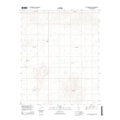
2015 Map of Pilot Knob Valley East
USGS Topo · Published 2015About this map
Mojave Desert terrain dominates this 2015 survey of northeastern San Bernardino County, capturing a landscape defined by broad alluvial fans and isolated mountain ridges. The sheet covers the eastern reaches of Pilot Knob Valley, where the arid basin floor meets the rising topography of the surrounding ranges. This modern digital survey by the U.S. Geological Survey provides a precise record of the desert's physical geography, including the sparse network of thoroughfares that penetrate the region. Notable routes such as Randsburg Rd and the utilitarian A Rd facilitate passage through this remote basin. The map is primarily an exercise in topographic detail, using forty-foot contour intervals to illustrate the complex drainage patterns and relief that characterize this portion of the California desert.
Find a feature on this map
10 named features on this map. Tap any name to fly to it.
Don’t see what you’re looking for? This feature index may not catch every label — zoom into the map to look around manually.
Map Details
Editions of this 2015 Pilot Knob Valley East Map
This is the sole edition of this map. No revisions or reprints were ever made.
Other maps of this area

1915 · Searles Lake
USGS Topo · 1:250,000

1933 · Avawatz Mountains
USGS Topo · 1:250,000

1947 · Trona
USGS Topo · 1:250,000

1948 · Trona
USGS Topo · 1:250,000

1948 · Quail Mountains
USGS Topo · 1:62,500

1948 · Goldstone Lake
USGS Topo · 1:62,500

1950 · Wingate Pass
USGS Topo · 1:62,500

1951 · Goldstone Lake
USGS Topo · 1:62,500

1951 · Wingate Pass
USGS Topo · 1:62,500

1951 · Quail Mountains
USGS Topo · 1:62,500