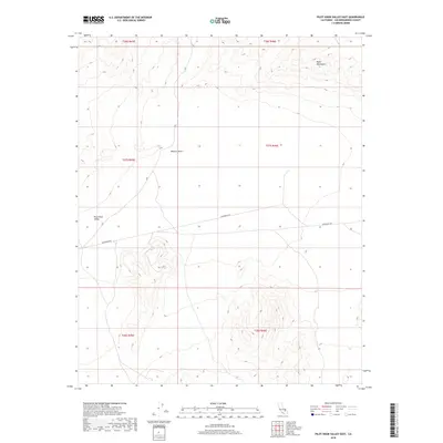
2018 Map of Pilot Knob Valley East
USGS Topo · Published 2018About this map
The Quail Mountains dominate the northeastern portion of this arid landscape, overlooking the expansive Mojave Desert floor. This 2018 survey emphasizes the isolation of the Pilot Knob Valley, a significant topographical depression in the western half of the quadrangle. Human impact on this portion of San Bernardino County remains sparse, represented primarily by the east-west passage of Randsburg Rd. The map illustrates a strictly arid environment where the high peaks of the Quails descend into flat basins, a typical pattern for this region of California. The preservation of large open spaces is underscored by the absence of permanent settlements, focusing instead on the land's natural contours and the critical transit route that connects this remote valley to the surrounding desert hubs.
Find a feature on this map
10 named features on this map. Tap any name to fly to it.
Don’t see what you’re looking for? This feature index may not catch every label — zoom into the map to look around manually.
Map Details
Editions of this 2018 Pilot Knob Valley East Map
This is the sole edition of this map. No revisions or reprints were ever made.
Other maps of this area

1915 · Searles Lake
USGS Topo · 1:250,000

1933 · Avawatz Mountains
USGS Topo · 1:250,000

1947 · Trona
USGS Topo · 1:250,000

1948 · Trona
USGS Topo · 1:250,000

1948 · Quail Mountains
USGS Topo · 1:62,500

1948 · Goldstone Lake
USGS Topo · 1:62,500

1950 · Wingate Pass
USGS Topo · 1:62,500

1951 · Goldstone Lake
USGS Topo · 1:62,500

1951 · Wingate Pass
USGS Topo · 1:62,500

1951 · Quail Mountains
USGS Topo · 1:62,500