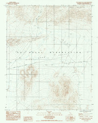
1984 Map of Pilot Knob Valley East
USGS Topo · Published 1984About this map
The U S Naval Reservation dominates this desert landscape in San Bernardino County, where restricted access and military utility define the terrain. Situated within the Pilot Knob Valley, the map details a region characterized by specialized infrastructure, including a Heliport and a Radio Tower, alongside water management features like a Water Well and several Levees. The high peaks of the Quail Mountains loom to the north, providing a stark topographical contrast to the valley floor below.
Find a feature on this map
12 named features on this map. Tap any name to fly to it.
Don’t see what you’re looking for? This feature index may not catch every label — zoom into the map to look around manually.
Map Details
Editions of this 1984 Pilot Knob Valley East Map
This is the sole edition of this map. No revisions or reprints were ever made.
Other maps of this area

1915 · Searles Lake
USGS Topo · 1:250,000

1933 · Avawatz Mountains
USGS Topo · 1:250,000

1947 · Trona
USGS Topo · 1:250,000

1948 · Trona
USGS Topo · 1:250,000

1948 · Quail Mountains
USGS Topo · 1:62,500

1948 · Goldstone Lake
USGS Topo · 1:62,500

1950 · Wingate Pass
USGS Topo · 1:62,500

1951 · Goldstone Lake
USGS Topo · 1:62,500

1951 · Wingate Pass
USGS Topo · 1:62,500

1951 · Quail Mountains
USGS Topo · 1:62,500