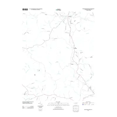
2013 Map of Pilot Mountain
USGS Topo · Published 2013About this map
Sunbright serves as a primary hub in this Morgan County landscape, where the local economy is deeply tied to the land. The map reveals an active industrial footprint through numerous energy production sites, including the Coon Hollow Oil Field, Sunbright Oil Field, and Pilot Mountain Oil Field. This concentration of resources reflects the area's ongoing role in Tennessee's energy sector.
Find a feature on this map
96 named features on this map. Tap any name to fly to it.
Don’t see what you’re looking for? This feature index may not catch every label — zoom into the map to look around manually.
Map Details
Editions of this 2013 Pilot Mountain Map
This is the sole edition of this map. No revisions or reprints were ever made.
Other maps of this area

1895 · Wartburg
USGS Topo · 1:125,000

1896 · Wartburg
USGS Topo · 1:125,000

1935 · Gobey
USGS Topo · 1:24,000

1935 · Camp Austin
USGS Topo · 1:24,000

1935 · Lancing
USGS Topo · 1:24,000

1935 · Pilot Mountain
USGS Topo · 1:24,000

1936 · Hebbertsburg
USGS Topo · 1:24,000

1936 · Twin Bridges
USGS Topo · 1:24,000
1943 · Hebbertsburg
USGS Topo · 1:24,000

1943 · Twin Bridges
USGS Topo · 1:24,000