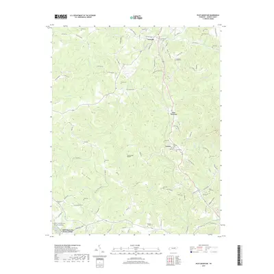
2019 Map of Pilot Mountain
USGS Topo · Published 2019About this map
Sunbright and Annadel anchor this survey of the Cumberland Plateau in Morgan County. The landscape is defined by a dense network of watercourses and ridges, including Buck Ridge and Pea Ridge, which separate the various branches of Rock Creek and White Oak Cr. The southern edge of the map is protected by the Obed Wild and Scenic River, where the terrain drops sharply toward the river corridor. For genealogists, the map is remarkably dense with family-named landmarks and burial sites, ranging from the Taylor Cem in the north to the Davidson / Forstner Cem near the southern boundary. These small cemeteries, often associated with specific lineages or local congregations like Stringfield Chapel Cem, provide a precise spatial record of settlement patterns across this portion of the Tennessee highlands.
Find a feature on this map
101 named features on this map. Tap any name to fly to it.
Don’t see what you’re looking for? This feature index may not catch every label — zoom into the map to look around manually.
Map Details
Editions of this 2019 Pilot Mountain Map
This is the sole edition of this map. No revisions or reprints were ever made.
Other maps of this area

1895 · Wartburg
USGS Topo · 1:125,000

1896 · Wartburg
USGS Topo · 1:125,000

1935 · Gobey
USGS Topo · 1:24,000

1935 · Camp Austin
USGS Topo · 1:24,000

1935 · Lancing
USGS Topo · 1:24,000

1935 · Pilot Mountain
USGS Topo · 1:24,000

1936 · Hebbertsburg
USGS Topo · 1:24,000

1936 · Twin Bridges
USGS Topo · 1:24,000
1943 · Hebbertsburg
USGS Topo · 1:24,000

1943 · Twin Bridges
USGS Topo · 1:24,000