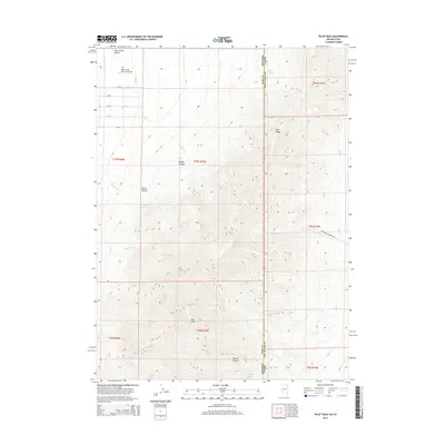
2014 Map of Pilot Peak
USGS Topo · Published 2014About this map
Pilot Peak dominates the center of this 2014 landscape, marking the high ground of the Pilot Range where the borders of Utah and Nevada meet. The terrain transitions from the high peaks down into the Pilot Creek Valley to the west, where a grid of rural roads such as 1st St and 9th St serve the area near the Pilot Creek Ranches Airport. This map illustrates the vital importance of water in the high desert, identifying several key water sources including McCushion Springs, Cove Springs, and Willow Spring. Topographic details reveal a network of drainages such as Debbs Canyon and Willow Canyon, alongside named watercourses like Buckhorn Cr and Bettridge Cr that flow from the mountains toward the valley floor.
Find a feature on this map
29 named features on this map. Tap any name to fly to it.
Don’t see what you’re looking for? This feature index may not catch every label — zoom into the map to look around manually.
Map Details
Editions of this 2014 Pilot Peak Map
This is the sole edition of this map. No revisions or reprints were ever made.
Other maps of this area

1953 · Tooele
USGS Topo · 1:250,000

1954 · Brigham City
USGS Topo · 1:250,000

1955 · Tooele
USGS Topo · 1:250,000

1955 · Wells
USGS Topo · 1:250,000

1955 · Elko
USGS Topo · 1:250,000

1958 · Wells
USGS Topo · 1:250,000

1958 · Elko
USGS Topo · 1:250,000

1958 · Brigham City
USGS Topo · 1:250,000

1961 · Wells
USGS Topo · 1:250,000

1962 · Elko
USGS Topo · 1:250,000