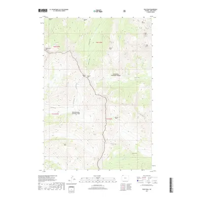
2017 Map of Pilot Peak
USGS Topo · Published 2017About this map
Yellowstone National Park and Shoshone National Forest meet in this 2017 survey of the high country in the Absaroka Range. The landscape is dominated by the iconic silhouettes of Pilot Peak and Index Peak, which stand as significant landmarks along the eastern boundary. This high-altitude terrain is accessible only via an extensive network of footpaths, such as the Republic Cr. Trail and Cache Creek Trail, which cross drainage divides at points like Republic Pass. The map highlights a complex hydrography of alpine headwaters, including Soda Butte Canyon and Guitar Lake, illustrating the pristine water sources that feed into the larger regional watersheds. This documentation reflects the modern management of these protected wilderness areas, showing how historical trail systems continue to provide the primary means of navigating the high peaks and deep canyons.
Find a feature on this map
28 named features on this map. Tap any name to fly to it.
Don’t see what you’re looking for? This feature index may not catch every label — zoom into the map to look around manually.
Map Details
Editions of this 2017 Pilot Peak Map
This is the sole edition of this map. No revisions or reprints were ever made.
Other maps of this area

1886 · Canyon
USGS Topo · 1:125,000

1891 · Livingston
USGS Topo · 1:250,000

1893 · Livingston
USGS Topo · 1:250,000

1895 · Canyon
USGS Topo · 1:125,000

1896 · Canyon
USGS Topo · 1:125,000

1896 · Crandall Creek
USGS Topo · 1:125,000

1898 · Granite Mountain District
USGS Topo · 1:125,000

1899 · Crandall
USGS Topo · 1:125,000

1901 · Canyon
USGS Topo · 1:125,000

1907 · Canyon
USGS Topo · 1:125,000