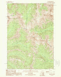
1989 Map of Pilot Peak
USGS Topo · Published 1989About this map
Pilot Peak and Index Peak dominate the northeastern corner of this 1989 survey, where the borders of the North Absaroka Wilderness and Yellowstone National Park converge within the Shoshone National Forest. This high-altitude landscape is characterized by its complex drainage systems, with Republic Creek and Hayden Creek carving paths through steep topography. The map illustrates a primitive transportation network, where a Pack Trail provides the primary means of navigating the high country near Republic Pass.
Find a feature on this map
19 named features on this map. Tap any name to fly to it.
Don’t see what you’re looking for? This feature index may not catch every label — zoom into the map to look around manually.
Map Details
Editions of this 1989 Pilot Peak Map
This is the sole edition of this map. No revisions or reprints were ever made.
Other maps of this area

1886 · Canyon
USGS Topo · 1:125,000

1891 · Livingston
USGS Topo · 1:250,000

1893 · Livingston
USGS Topo · 1:250,000

1895 · Canyon
USGS Topo · 1:125,000

1896 · Canyon
USGS Topo · 1:125,000

1896 · Crandall Creek
USGS Topo · 1:125,000

1898 · Granite Mountain District
USGS Topo · 1:125,000

1899 · Crandall
USGS Topo · 1:125,000

1901 · Canyon
USGS Topo · 1:125,000

1907 · Canyon
USGS Topo · 1:125,000