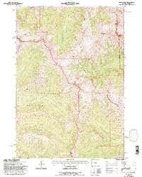
1991 Map of Pilot Peak
USGS Topo · Published 1997About this map
Yellowstone National Park and the Shoshone North Absaroka Wilderness National Forest converge in this high-altitude landscape. The terrain is dominated by prominent summits including Pilot Peak and Index Peak, which serve as dramatic landmarks along the eastern boundary. The intricate drainage network is defined by North Fork Crandall Creek and its various tributaries, while high-elevation water bodies like Guitar Lake sit tucked beneath Amphitheater Mountain.
Find a feature on this map
18 named features on this map. Tap any name to fly to it.
Don’t see what you’re looking for? This feature index may not catch every label — zoom into the map to look around manually.
Map Details
Editions of this 1991 Pilot Peak Map
This is the sole edition of this map. No revisions or reprints were ever made.
Other maps of this area

1886 · Canyon
USGS Topo · 1:125,000

1891 · Livingston
USGS Topo · 1:250,000

1893 · Livingston
USGS Topo · 1:250,000

1895 · Canyon
USGS Topo · 1:125,000

1896 · Canyon
USGS Topo · 1:125,000

1896 · Crandall Creek
USGS Topo · 1:125,000

1898 · Granite Mountain District
USGS Topo · 1:125,000

1899 · Crandall
USGS Topo · 1:125,000

1901 · Canyon
USGS Topo · 1:125,000

1907 · Canyon
USGS Topo · 1:125,000