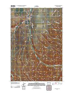
2011 Map of Pilot Rock
USGS Topo · Published 2011About this map
Pilot Rock serves as the primary hub in this Umatilla County landscape, where the confluence of West Birch Creek and East Birch Creek forms the main stem of Birch Creek. This 2011 survey details the transition from the town's residential grid to the surrounding agricultural and timber lands. Rural infrastructure is defined by a network of family and utility routes, including Cemetery Rd and Schoolhouse Rd, which suggest the locations of early community centers and homesteads. The topography is marked by several notable drainages such as California Gulch, Spring Hollow, and Dry Hollow, which feed the various tributaries of the Birch Creek system. To the east, Johnson Creek and Little McKay Creek carve into the upland terrain, while named routes like Porter Rd and Shaw Rd provide access to the higher elevations and gulches like Park Gulch.
Find a feature on this map
25 named features on this map. Tap any name to fly to it.
Don’t see what you’re looking for? This feature index may not catch every label — zoom into the map to look around manually.
Map Details
Editions of this 2011 Pilot Rock Map
This is the sole edition of this map. No revisions or reprints were ever made.
Other maps of this area

1935 · Pendleton
USGS Topo · 1:125,000

1953 · Pendleton
USGS Topo · 1:250,000

1956 · Pendleton
USGS Topo · 1:250,000

1966 · Mc Kay Reservoir
USGS Topo · 1:24,000

1966 · Table Rock
USGS Topo · 1:24,000
1966 · Coombs Canyon
USGS Topo · 1:24,000

1967 · Nye
USGS Topo · 1:24,000

1967 · Granite Meadows
USGS Topo · 1:24,000

1967 · Carney Butte
USGS Topo · 1:24,000

1967 · Pilot Rock
USGS Topo · 1:24,000