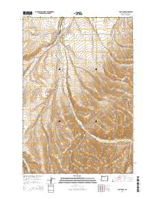
2014 Map of Pilot Rock
USGS Topo · Published 2014About this map
Pilot Rock serves as the focal point for this landscape, where the town's residential streets like North Alder St and Southwest Birch St meet the industrial character of Mill Rd. The topography is defined by the convergence of several drainage systems, most notably Birch Creek and its branches, which carve through the high plateaus of Umatilla County. Outside the town limits, the terrain becomes increasingly complex with features like Jack Canyon and Dry Hollow illustrating the deeply eroded basalt geography of the region.
Find a feature on this map
39 named features on this map. Tap any name to fly to it.
Don’t see what you’re looking for? This feature index may not catch every label — zoom into the map to look around manually.
Map Details
Editions of this 2014 Pilot Rock Map
This is the sole edition of this map. No revisions or reprints were ever made.
Other maps of this area

1935 · Pendleton
USGS Topo · 1:125,000

1953 · Pendleton
USGS Topo · 1:250,000

1956 · Pendleton
USGS Topo · 1:250,000

1966 · Mc Kay Reservoir
USGS Topo · 1:24,000

1966 · Table Rock
USGS Topo · 1:24,000
1966 · Coombs Canyon
USGS Topo · 1:24,000

1967 · Nye
USGS Topo · 1:24,000

1967 · Granite Meadows
USGS Topo · 1:24,000

1967 · Carney Butte
USGS Topo · 1:24,000

1967 · Pilot Rock
USGS Topo · 1:24,000