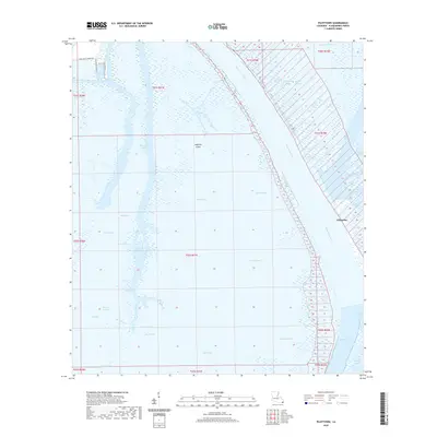
2020 Map of Pilottown
USGS Topo · Published 2020About this map
Pilottown anchors this riverine survey of the outermost reaches of Plaquemines Parish, where the Mississippi River begins its final division into the bird-foot delta. The landscape is a complex labyrinth of bayous, passes, and ponds, including Mary Bowers Pond and Twin Lakes. These wetlands are shaped by the heavy sediment of the river as it flows toward the Gulf of Mexico via major outlets like Main Pass, South Pass, and Southwest Pass.
Find a feature on this map
48 named features on this map. Tap any name to fly to it.
Don’t see what you’re looking for? This feature index may not catch every label — zoom into the map to look around manually.
Map Details
Editions of this 2020 Pilottown Map
This is the sole edition of this map. No revisions or reprints were ever made.
Other maps of this area

1893 · East Delta
USGS Topo · 1:62,500

1893 · Forts
USGS Topo · 1:62,500

1893 · West Delta
USGS Topo · 1:62,500

1935 · South Pass
USGS Topo · 1:31,680

1946 · Pass Du Bois
USGS Topo · 1:31,680

1946 · Pass Tante Phine
USGS Topo · 1:31,680

1947 · Pass A Loutre West
USGS Topo · 1:31,680

1947 · Venice
USGS Topo · 1:31,680

1947 · Fort St. Philip
USGS Topo · 1:31,680

1947 · Southwest Pass
USGS Topo · 1:31,680