1893 Map of Forts
USGS Topo · Published 1893About this map
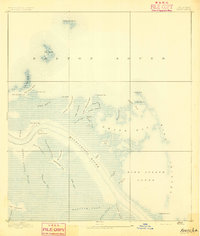
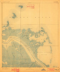
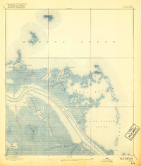
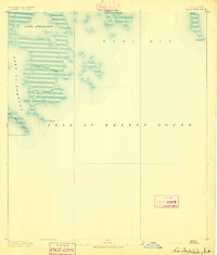
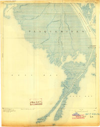
Fort Jackson and Fort St. Phillip stand as the primary sentinels of the lower Mississippi River in this late 19th-century survey. Positioned on opposing banks at a critical bend in the river, these fortifications highlight the strategic military importance of the Plaquemines region long after the American Civil War. The landscape is a labyrinth of marsh and open water, where the river's main channel is flanked by a complex network of bayous and canals, including the Lucas Canal and Salt Works Canal.
Find a feature on this map
49 named features on this map. Tap any name to fly to it.
Don’t see what you’re looking for? This feature index may not catch every label — zoom into the map to look around manually.
Map Details
Editions of this 1893 Forts Map
4 editions found

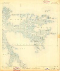
Other maps of this area

1892 · Quarantine
USGS Topo · 1:62,500
1893 · East Delta
USGS Topo · 1:62,500
1893 · La Fortuna
USGS Topo · 1:62,500

1893 · Dime
USGS Topo · 1:62,500
1893 · West Delta
USGS Topo · 1:62,500

1935 · Taylor Pass
USGS Topo · 1:31,680

1935 · Tropical Bend
USGS Topo · 1:31,680

1941 · Black Bay
USGS Topo · 1:62,500
1941 · Empire
USGS Topo · 1:62,500

1944 · Black Bay
USGS Topo · 1:62,500