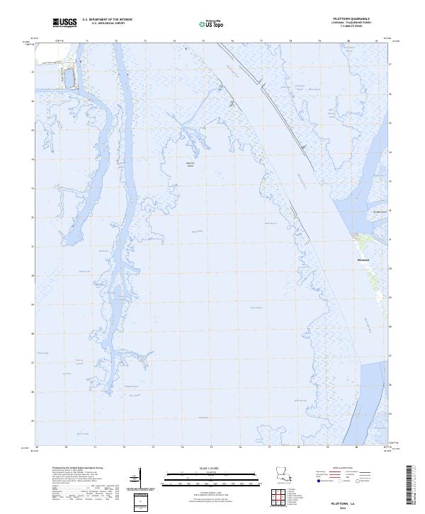
2024 Map of Pilottown
USGS Topo · Published 2024About this map
Pilottown stands as the primary outpost of human settlement in this watery reach of the Mississippi Delta, positioned at the critical head of passes where the Mississippi River splits into its final ocean-bound channels. This 2024 survey captures the intricate network of distributaries and bays that characterize Plaquemines Parish, including the massive South Pass and Southwest Pass. Much of the eastern terrain falls within the Delta National Wildlife Refuge, a landscape of marsh and small islands like Savage Island and Jaquines Island. The map reveals the essential maritime infrastructure of the region, from the Main Pass to the localized channels of Tiger Pass and Grand Pass. This environment is a complex assembly of brackish water bodies like Portage Bay and Zinzin Bay, illustrating how the delta's shifting sediment and hydrology continue to shape the southern tip of Louisiana.
Find a feature on this map
51 named features on this map. Tap any name to fly to it.
Don’t see what you’re looking for? This feature index may not catch every label — zoom into the map to look around manually.
Map Details
Editions of this 2024 Pilottown Map
This is the sole edition of this map. No revisions or reprints were ever made.
Other maps of this area

1893 · East Delta
USGS Topo · 1:62,500

1893 · Forts
USGS Topo · 1:62,500

1893 · West Delta
USGS Topo · 1:62,500

1935 · South Pass
USGS Topo · 1:31,680

1946 · Pass Du Bois
USGS Topo · 1:31,680

1946 · Pass Tante Phine
USGS Topo · 1:31,680

1947 · Pass A Loutre West
USGS Topo · 1:31,680

1947 · Venice
USGS Topo · 1:31,680

1947 · Fort St. Philip
USGS Topo · 1:31,680

1947 · Southwest Pass
USGS Topo · 1:31,680