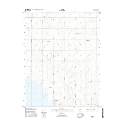
2015 Map of Pilsen
USGS Topo · Published 2015About this map
Pilsen sits at the heart of this central Kansas landscape, a rural community defined by its rolling topography and the drainage network of Mud Cr. The southeastern portion of the sheet is dominated by the sprawling waters of the Marion Reservoir, which has reshaped the local geography and created the residential pocket of Eastshore along its banks. The map provides a detailed look at the section lines and rural road network, including names like Old Mill Rd and Nighthawk Rd that hint at the area's agricultural history. Local heritage is further anchored by the Pilsen Cem near the town center and the Strassburg Cem to the south, offering vital geographic points for genealogical research into the region's farming families. The winding course of Clear Cr cuts across the southeastern corner, where the terrain begins to slope toward the reservoir basin.
Find a feature on this map
32 named features on this map. Tap any name to fly to it.
Don’t see what you’re looking for? This feature index may not catch every label — zoom into the map to look around manually.
Map Details
Editions of this 2015 Pilsen Map
This is the sole edition of this map. No revisions or reprints were ever made.
Other maps of this area

1889 · Newton
USGS Topo · 1:125,000

1889 · Abilene
USGS Topo · 1:125,000

1889 · Parkerville
USGS Topo · 1:125,000

1894 · Newton
USGS Topo · 1:125,000

1894 · Abilene
USGS Topo · 1:125,000

1894 · Parkerville
USGS Topo · 1:125,000

1898 · Cottonwood Falls
USGS Topo · 1:125,000

1955 · Hutchinson
USGS Topo · 1:250,000

1957 · Lincolnville SW
USGS Topo · 1:24,000

1959 · Hutchinson
USGS Topo · 1:250,000