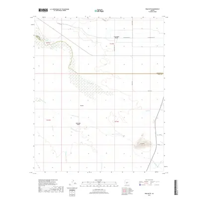
2018 Map of Pima Butte
USGS Topo · Published 2018About this map
The confluence of desert hydrology and historic settlement defines this corner of Pinal County. Maricopa Wells stands as a focal point in a landscape shaped by the braided paths of the Gila River and its major tributaries, including the Santa Cruz Wash, Santa Rosa Wash, and Vekol Wash. These natural drainages are supplemented by man-made agricultural features such as the Hoover Ditch and Santa Cruz Ditch, illustrating the area's long-standing reliance on water management in an arid environment.
Find a feature on this map
24 named features on this map. Tap any name to fly to it.
Don’t see what you’re looking for? This feature index may not catch every label — zoom into the map to look around manually.
Map Details
Editions of this 2018 Pima Butte Map
This is the sole edition of this map. No revisions or reprints were ever made.
Other maps of this area

1912 · Phoenix
USGS Topo · 1:62,500

1913 · Mesa
USGS Topo · 1:62,500

1913 · Maricopa
USGS Topo · 1:62,500

1914 · Gila Butte
USGS Topo · 1:62,500

1914 · Phoenix
USGS Topo · 1:62,500

1915 · Mesa
USGS Topo · 1:62,500

1915 · Maricopa
USGS Topo · 1:62,500

1917 · Gila Butte
USGS Topo · 1:62,500

1952 · Maricopa
USGS Topo · 1:24,000

1952 · Sacaton Butte
USGS Topo · 1:24,000